
About Us
Establish in 2015 Shriti Survey Consulting Pvt. Ltd. Is an emerging organisation with a goal of getting the best results in the industry.
Our formation holds an excellence level knowledge and practical experience in the field of Survey, GIS and Remote Sensing.
The company's continuing objective is to provide all the services with a keen observation and monitoring of the projects with efficiency, accuracy and quality at its best.
The company provides support to their clients regarding each requirements as well as queries at the any hour of time.
With the immense amount of accumulated knowledge and experience among the experts in the company, the hard work and analytic efforts holds us to continue the good work.
Geographic Information System
Read MoreService
We are expertise in following
Topographical Survey
We are expertise in all type of land survey. Total Station Survey, GPS Survey, DGPS Survey
GIS Mapping
Get along with us having the technology of mapping and analysis in global dimensions and have preserve your data geographically accurate for the ages. Also, have the Web Map Service(aka WebGIS).
Remote Sensing
With us you can ponder over the difficulties of analyzing and decision making for the projects involving extraction ,identification, classification,mapping etc. for the numerous amount of natural and man-made resources.
Map Digitization
We are expert in toposheet digitization, Georeferencing and Overlay mapping analysis
FEATURED PROJECTS
We are expertise in Water Distribution Survey, Sewage Survey, Road Survey, Dizitization
-
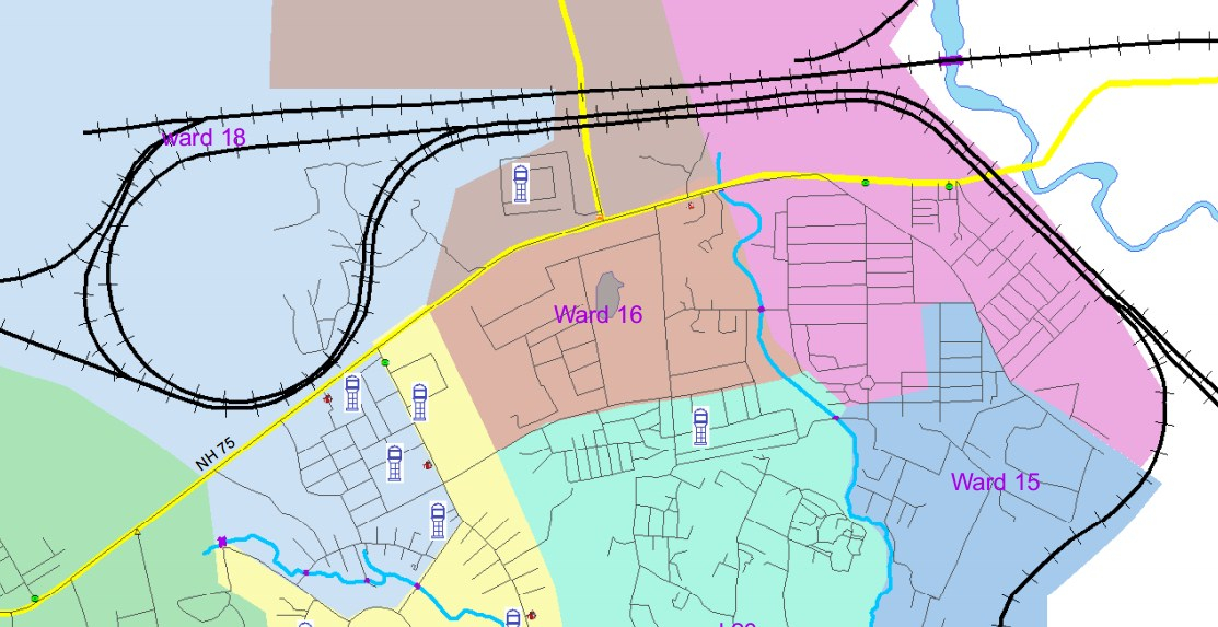
Water Distribution
GIS Map of Water Distribution Network Waidhan, Singrauli, Madhya Pradesh
-
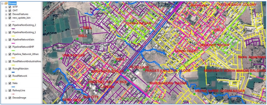
Overlay Map
Water Distribution Map of Dewas town, Madhya Pradesh with pipeline network categorised and overlayed on the Georeference Satellite Map
-
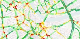
Traffic Flow Analysis
At Shristi Survey Consulting Pvt Ltd we GIS experts for Traffic flow analysis
-
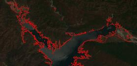
Remote Sensing Application
We are expert in analysis of satellite images and extracting features from the satellite images and identification of patterns and change detection
-

Topographical Survey
We have a good team trained in Total Station for topographical Survey
-
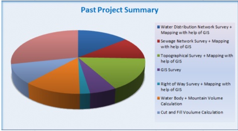
Past Project Summary
The pie chart showing our area of expertise and number of completed froject in last one year.
Key Peoples
M.Tech (Geoinfomatics and Remote Sensing) from NIT Bhopal. Having 4 years of experience in the field of GIS and Remote Sensing, work on various GIS based analysis projects. Having good knowledge of map automation, Cartography. Knowledge of various GIS software like ArcGIS Desktop, ArcGIS Server, Oracle Geospatial, QGIS, ArcGIS API for JavaScript, ArcGIS Online, AutoCAD. Area of Expertise is land management System. Right of Way domain. Land Acquisition System. He has delivered many expert lectures on various remote sensing and GIS topics at various national level institutes to the professionals and the students.
M.Tech (Geoinfomatics and Remote Sensing) from NIT Bhopal. Mr. Pankaj has deep knowledge and understanding on various survey technologies and methods. He has a deep experience on working with different survey instruments. Like Total Station, GPS, DGPS, DGPS-RTK, Auto Level, Theodolite. He is expertise in the field of survey and GIS based mapping. He has excellent command on GIS and Remote Sensing Software’s like ERDAS, ArcGIS, QGIS and AutoCAD. Mr. Pankaj has also written research publication on accuracy assessment of various total station instruments.
M.Tech (Geoinfomatics and Remote Sensing) from NIT Bhopal. Mr. Praveen has deep knowledge and understanding on various survey technologies and methods. He holds a long experience on working with different survey instruments. Apart from his expertise in the field of survey and geomatics engineering. He is a very good photographer and thinker.
Contact
Leave a Message
Contact Us
Shristi Survey Consulting Pvt LtdFirst Floor, Plot No 249 Shirdipuram, Kolar Road Bhopal Pin 462042, Madhya Pradesh India
Phone: 0755-4913465
Mobile: 8234016770/9993711210/9685249070
sscplbhopal@gmail.com
FOLLOW US
Beautifully simple follow buttons to help you get followers on